Headframes, the Heart of Butte
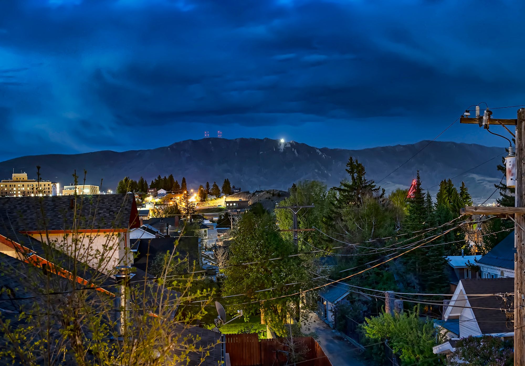
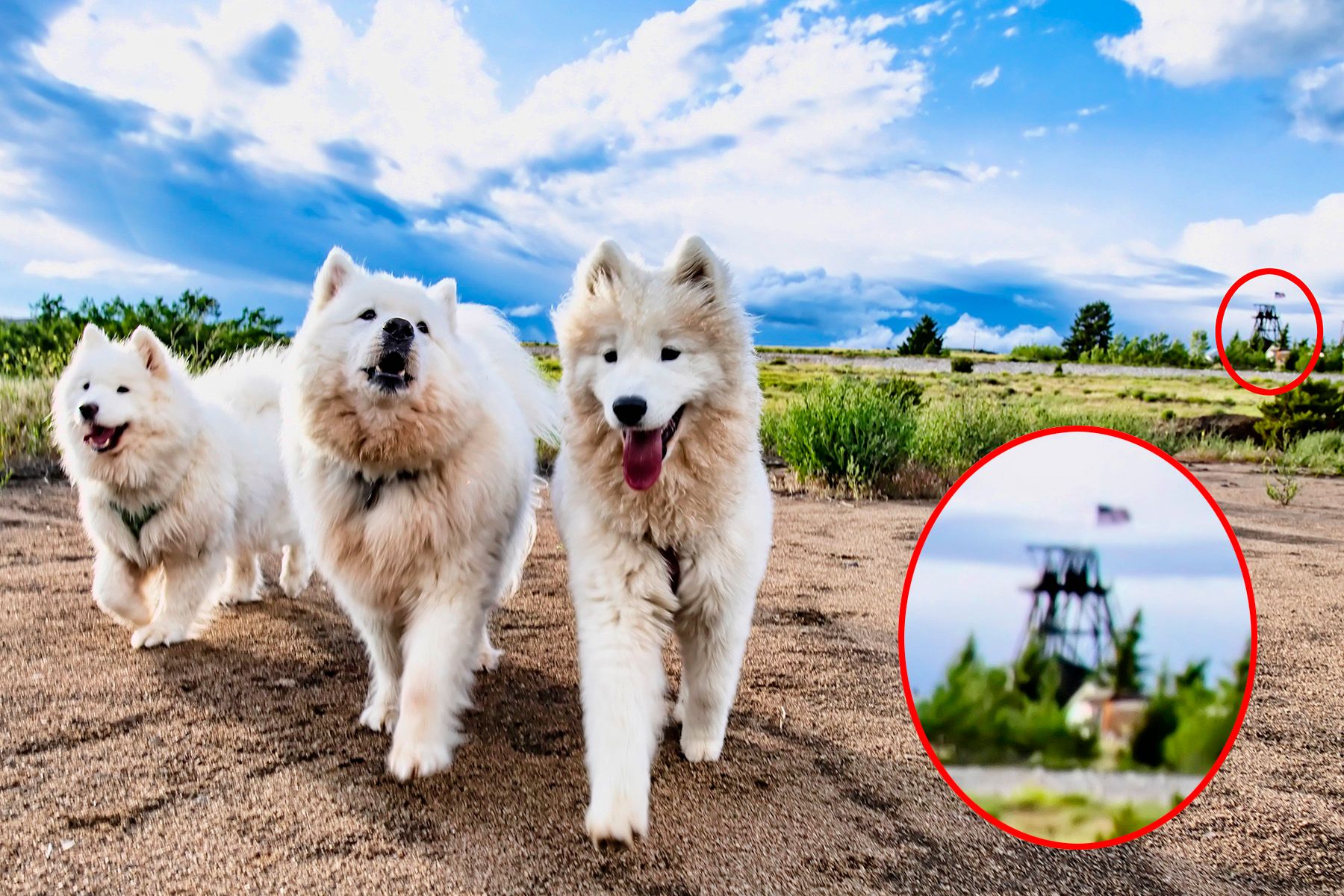
Headframes are the iconic symbol of Butte. Ranging from 100 to 200 feet tall, the 14 that remain standing punctuate the skyline of the Uptown District, Centerville, and Walkerville on "The Richest Hill on Earth."
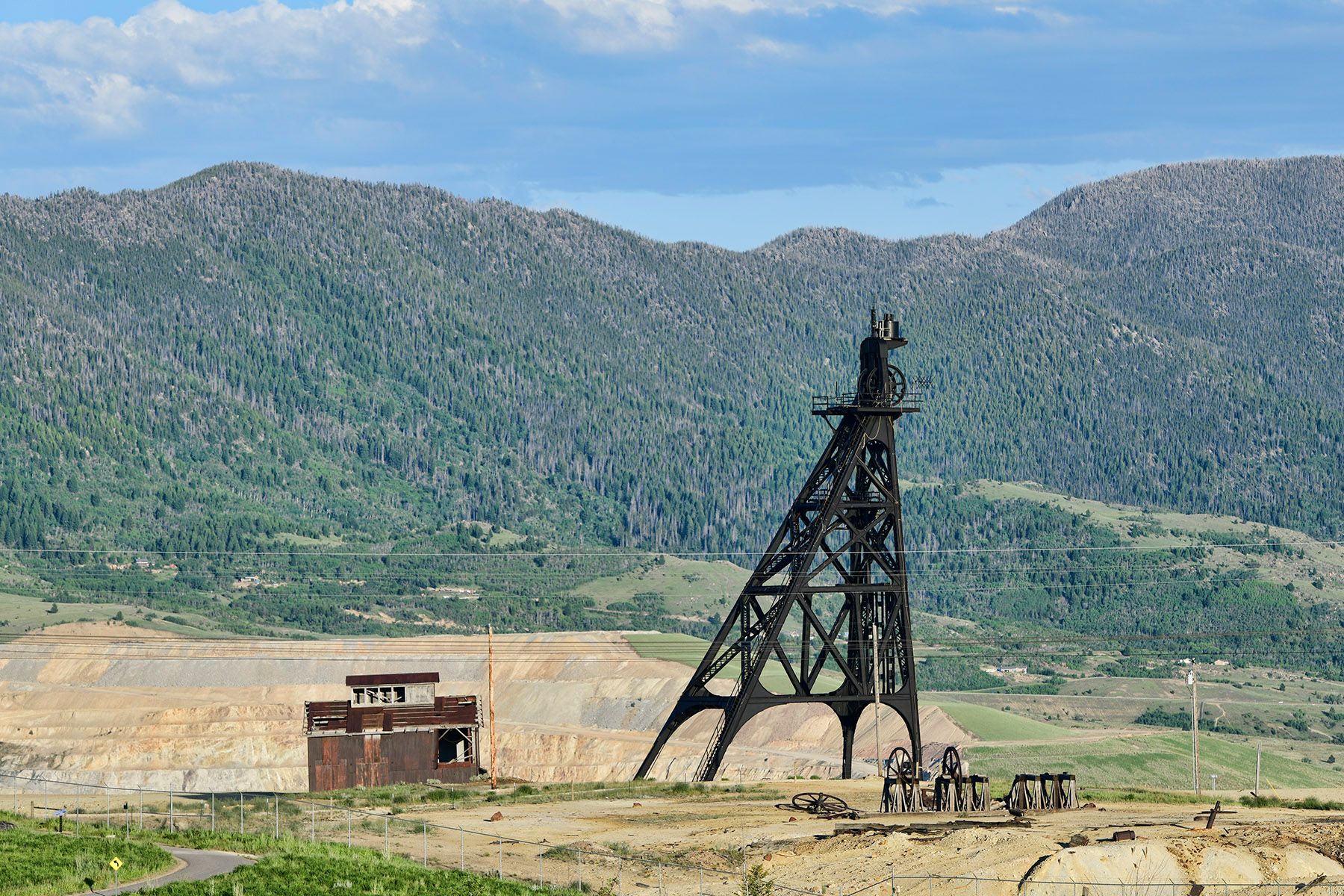
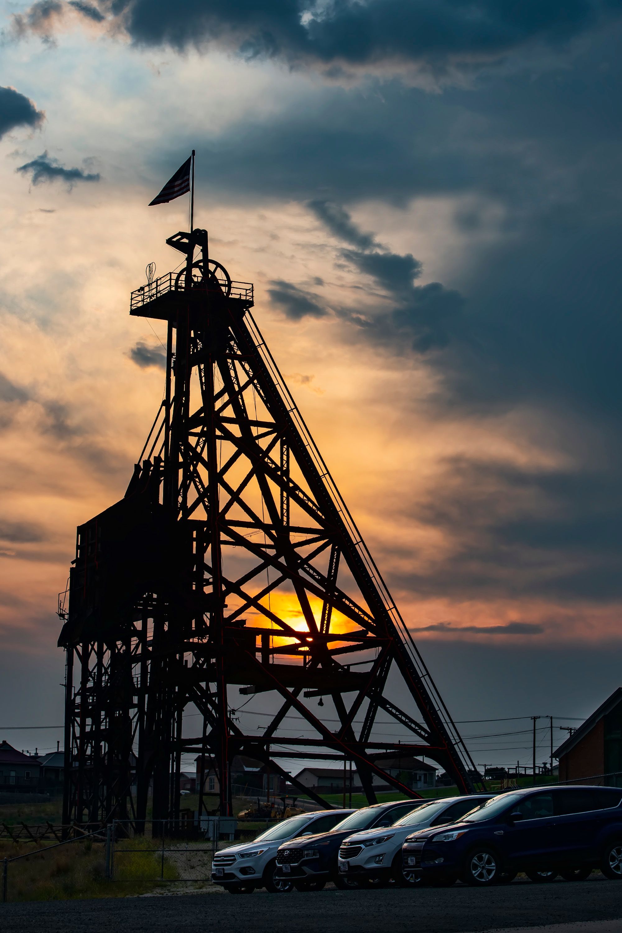
Originally called gallows frames, these steel structures standing above mineshafts were used to lower miners and their equipment into the darkness below, and – if all went well – lift them safely back out later, along with massive quantities of ore and precious metals.
Each headframe has one or more giant pulleys at the top, and steel cables ran from a nearby hoist house over the pulleys and down into the mineshafts. Most hoist houses were originally powered by steam engines, then some switched to compressed air power and eventually most used electric motors.
A total of 14 headframes remain standing in Butte, on preserved and protected historic sites. In this post, I'll share photos I've taken of a few of the most prominent ones since moving here a few months ago. Every headframe has a story, and I'll share a few of those here as well.
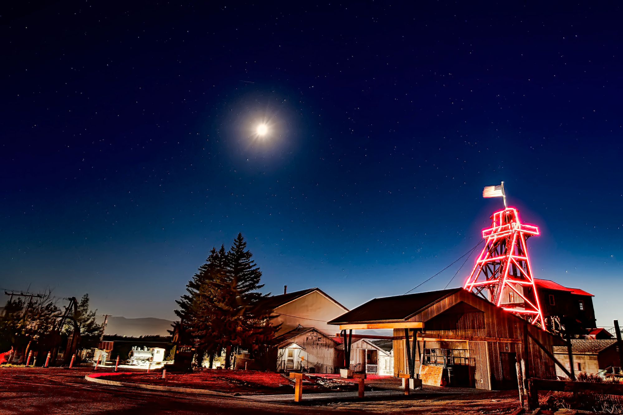
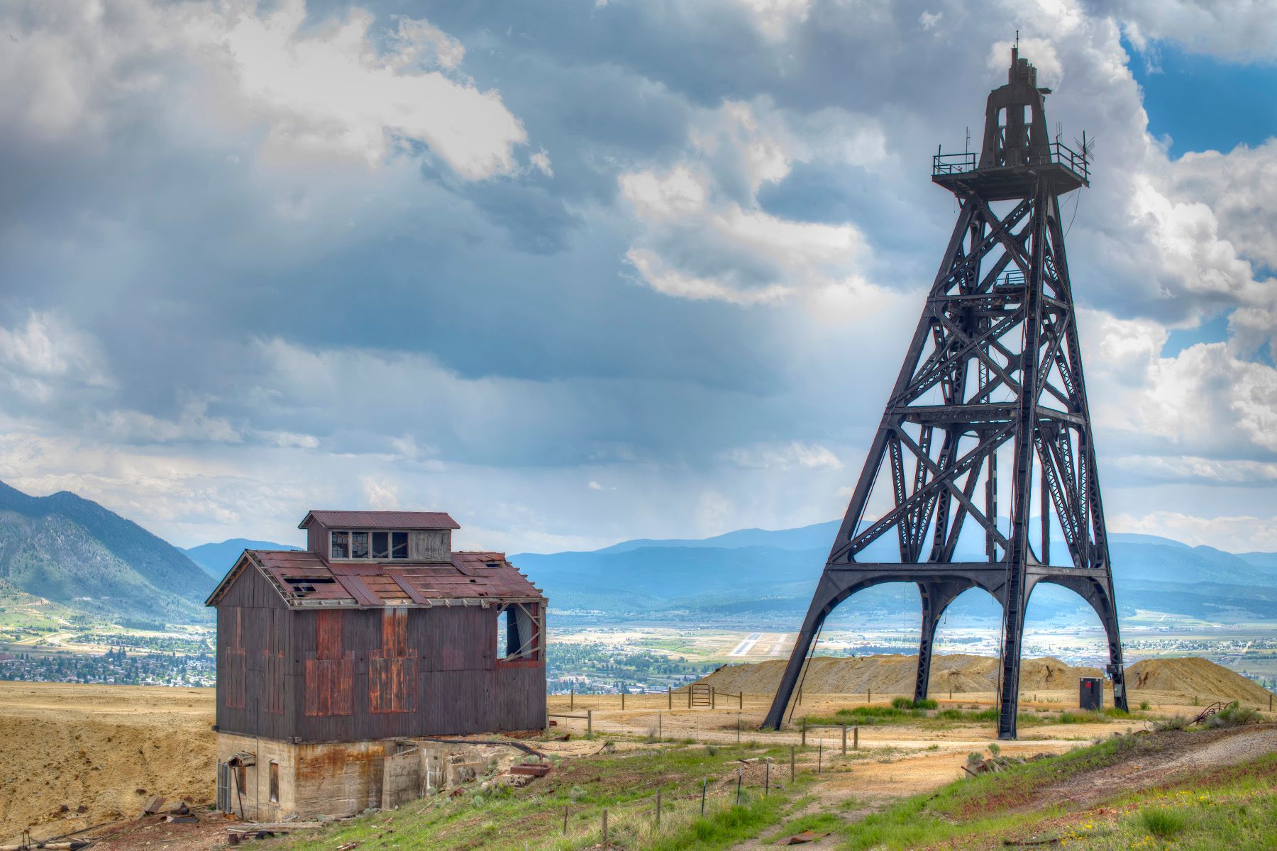
Travona
The Travona was Butte's first major mine, the one that drew thousands of miners to the area and literally put Butte on the map. It was originally a gold mine named the Asteroid after discover of gold there in 1864. Bill Farlin staked his claim for a silver mine at the site in 1874, and the name was changed to the Travona in 1879. People often misspelled it Travonia; for example, Travonia Street is a block east of Travona Mine.
Bill Farlin didn't have the money to fully develop his discovery, so he took out a $30,000 loan from a Deer Lodge banker named W. A. Clark. When Farlin defaulted on the loan, Clark took over the mine, and went on to become the first of Butte's three "Copper Kings." Clark amassed a fortune of $150 million (the equivalent of over $2 billion today), and his former residence in Uptown is now the Copper King Mansion, a popular bed & breakfast.
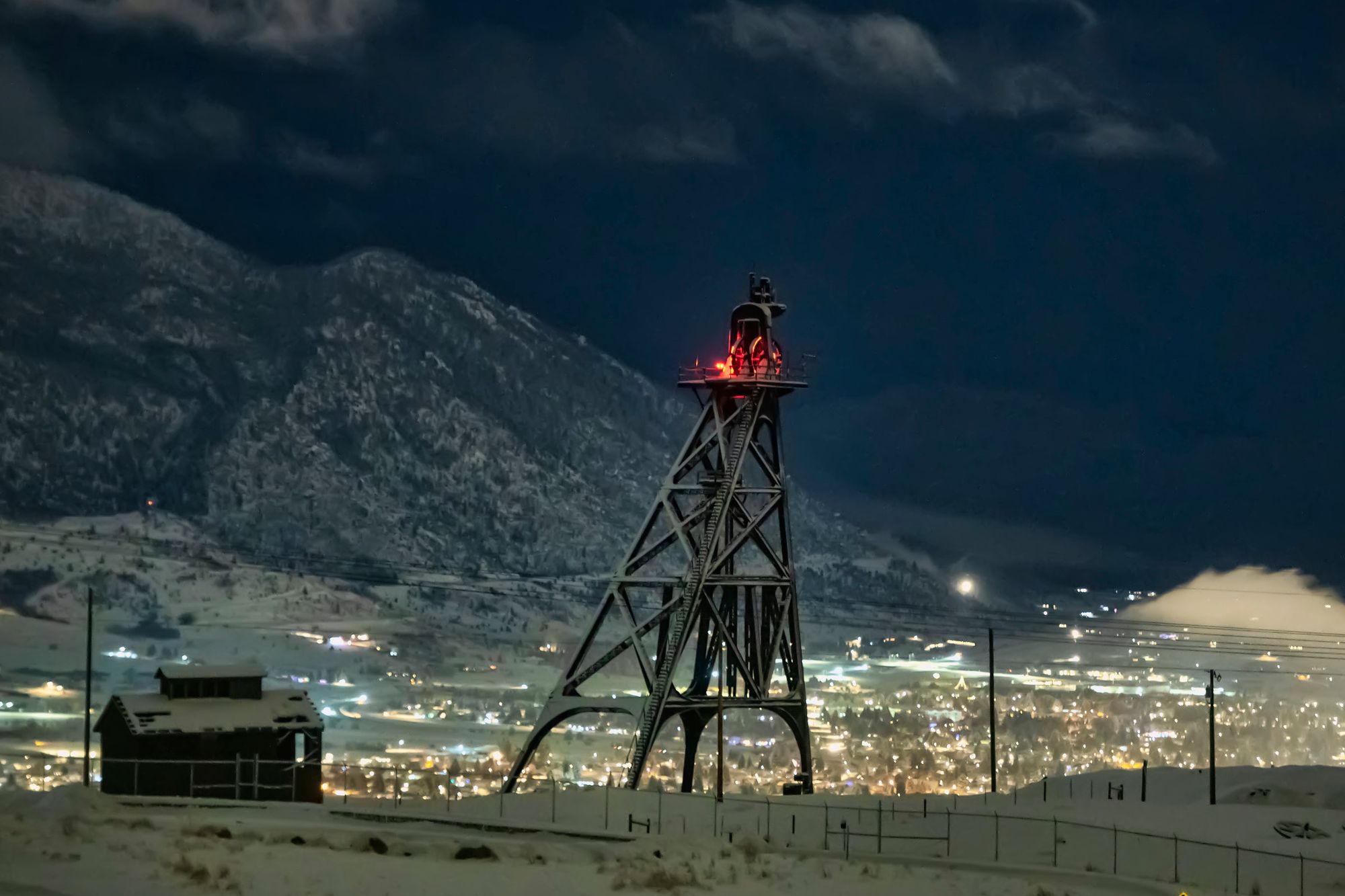
The massive steel headframe at the Travona was originally located at the Pennsylvania Mine. It was relocated to the Travona in 1940, and the Pennsylvania Mine site was later consumed by the growth of Berkeley Pit. Mining operations at the Travona stopped in 1954.
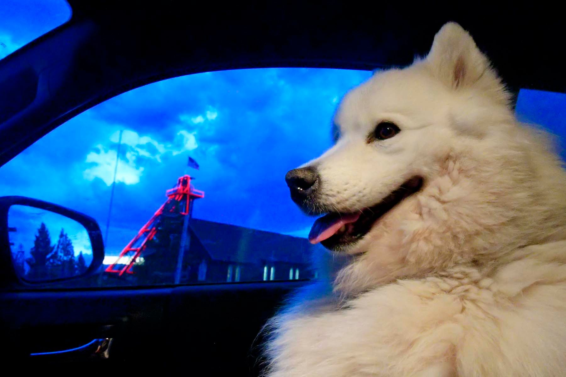
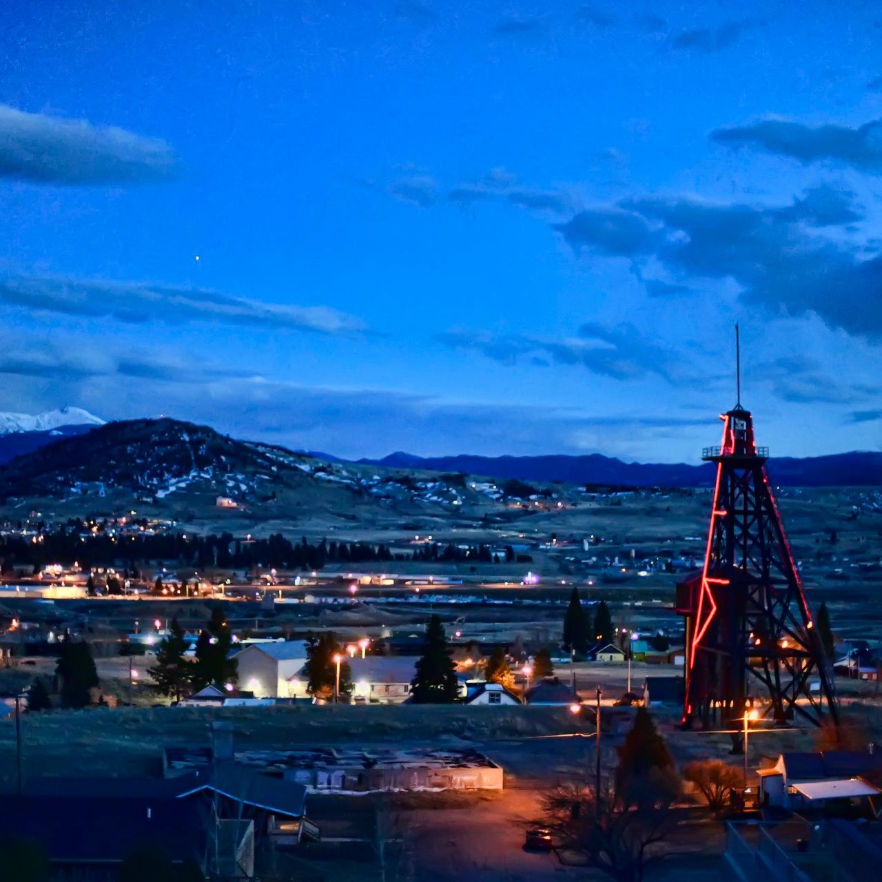
In 2003, the Travona became the first of Butte's headframes to be outfitted with high-efficiency red LED lights that make it visible from long distances even on the darkest night. Since then, 8 of the 14 standing headframes have been adorned with lights.
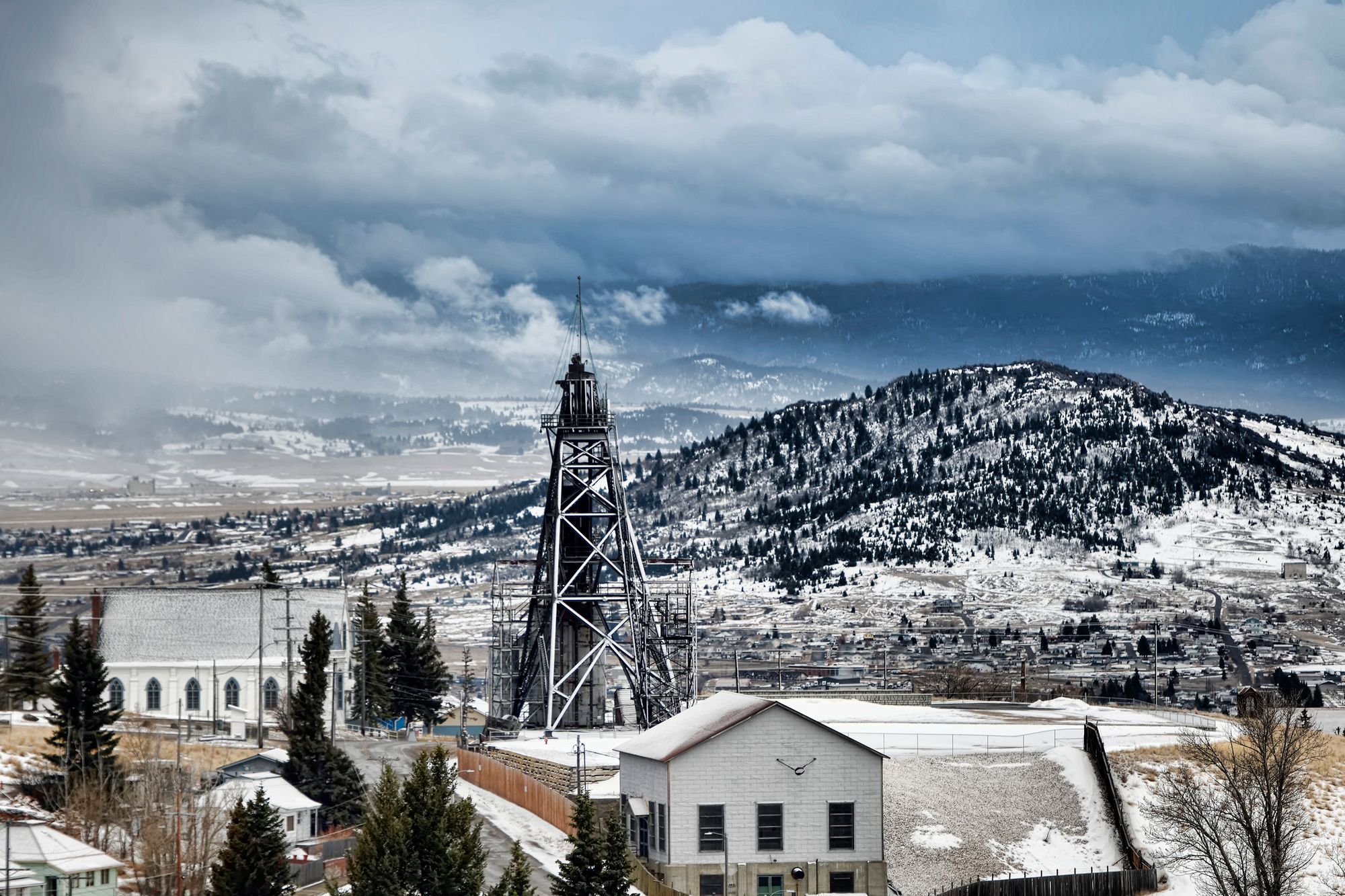
Original
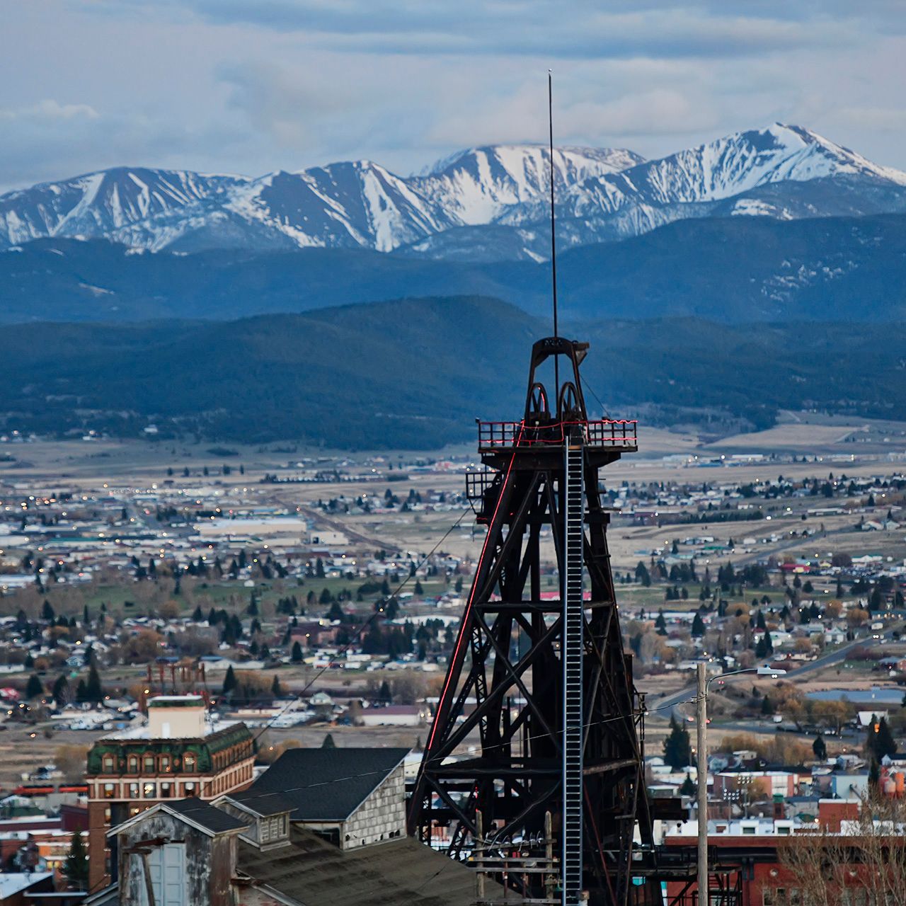
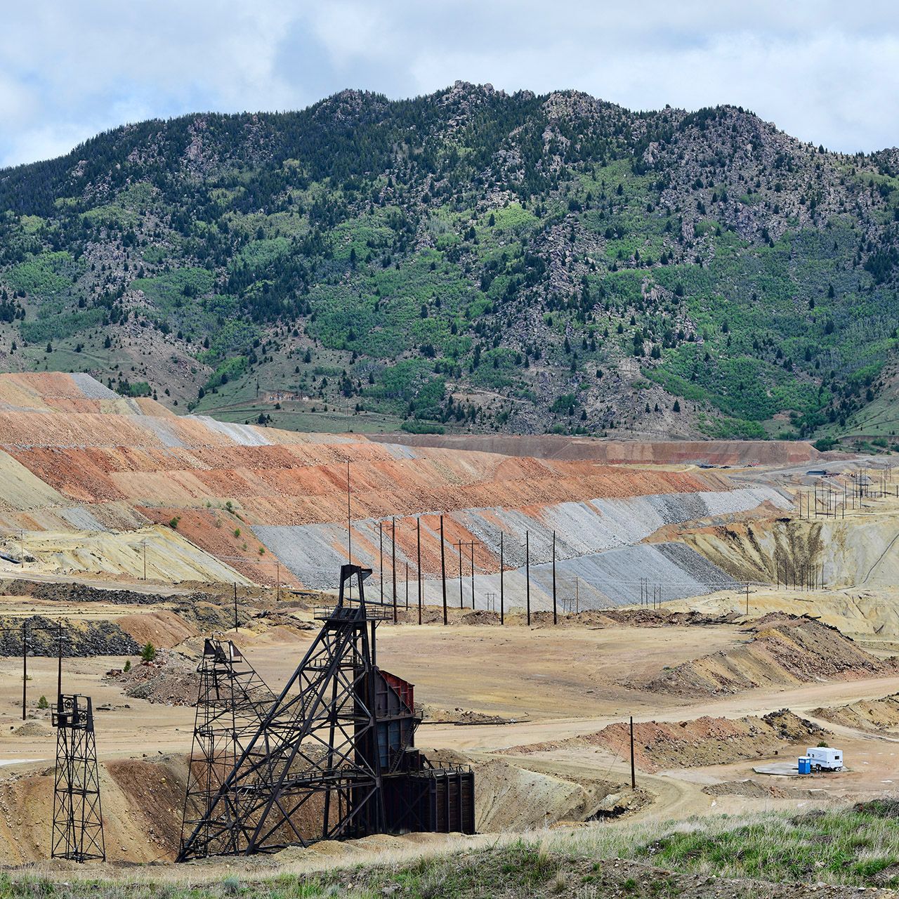
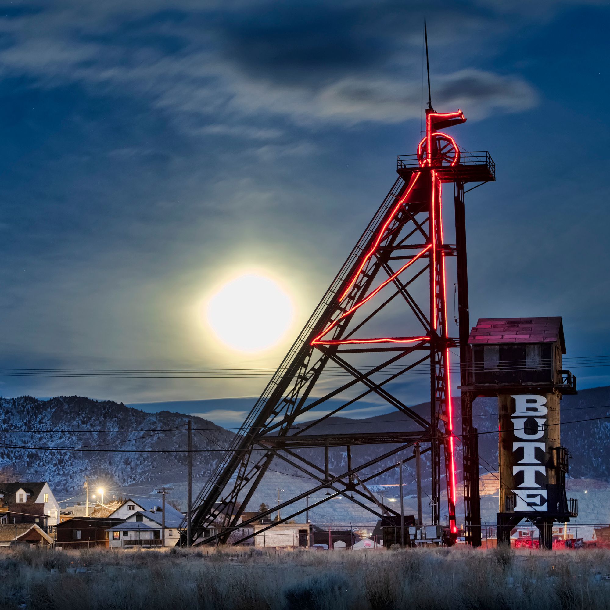
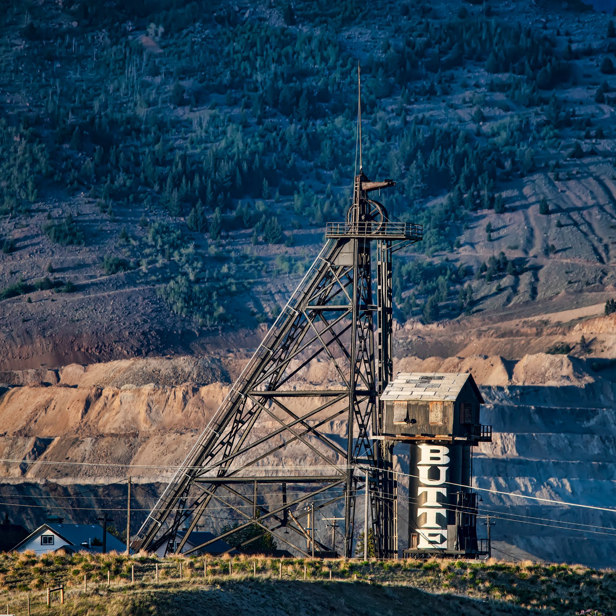
Even before the Travona, in 1864 two prospectors came across some elk horns on a hillside above a high valley in the newly formed Montana Territory. The horns appeared to have been used as digging implements, and nearby was a hole a few feet deep. Digging further, the prospectors found silver deposits. The site eventually became the Original Mine.
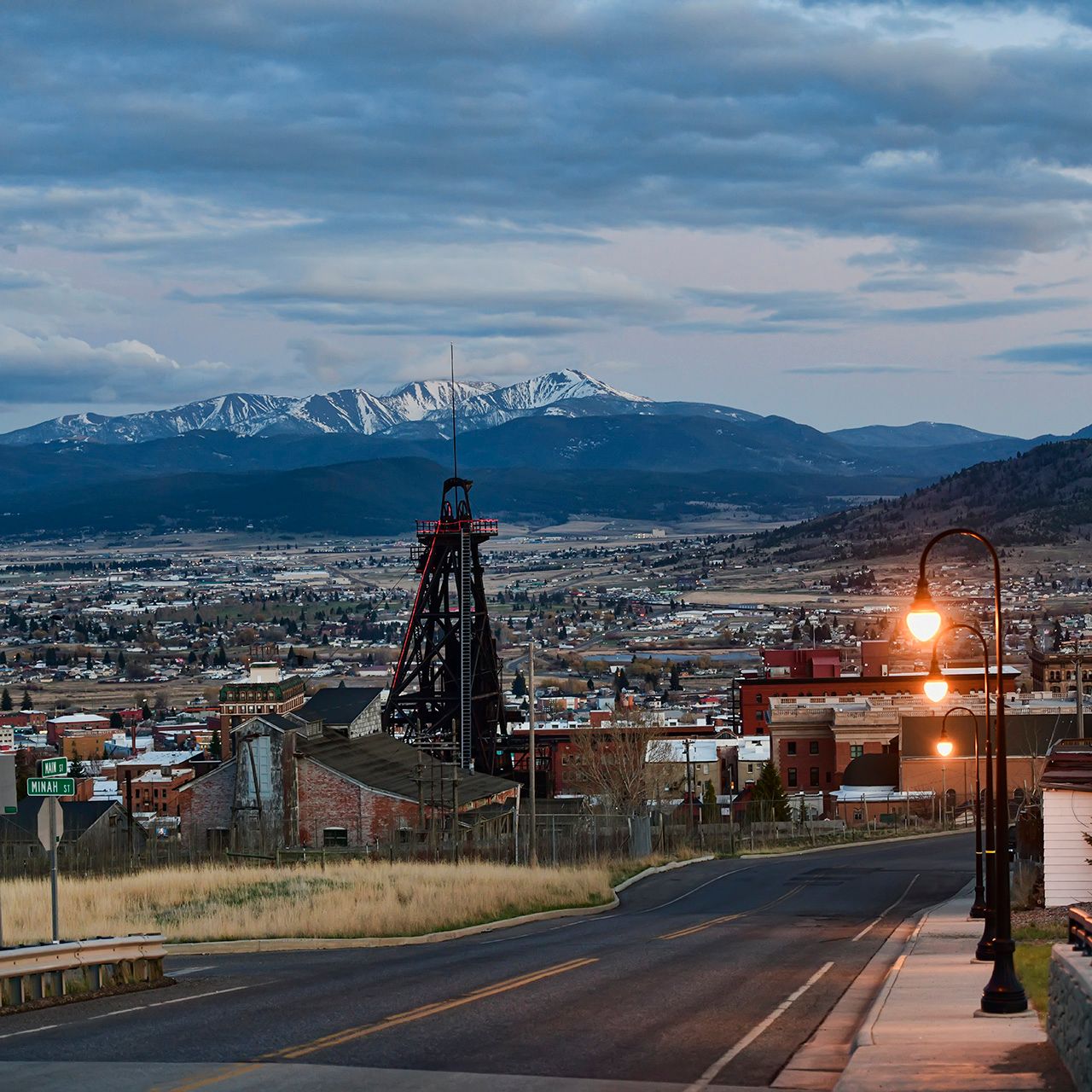
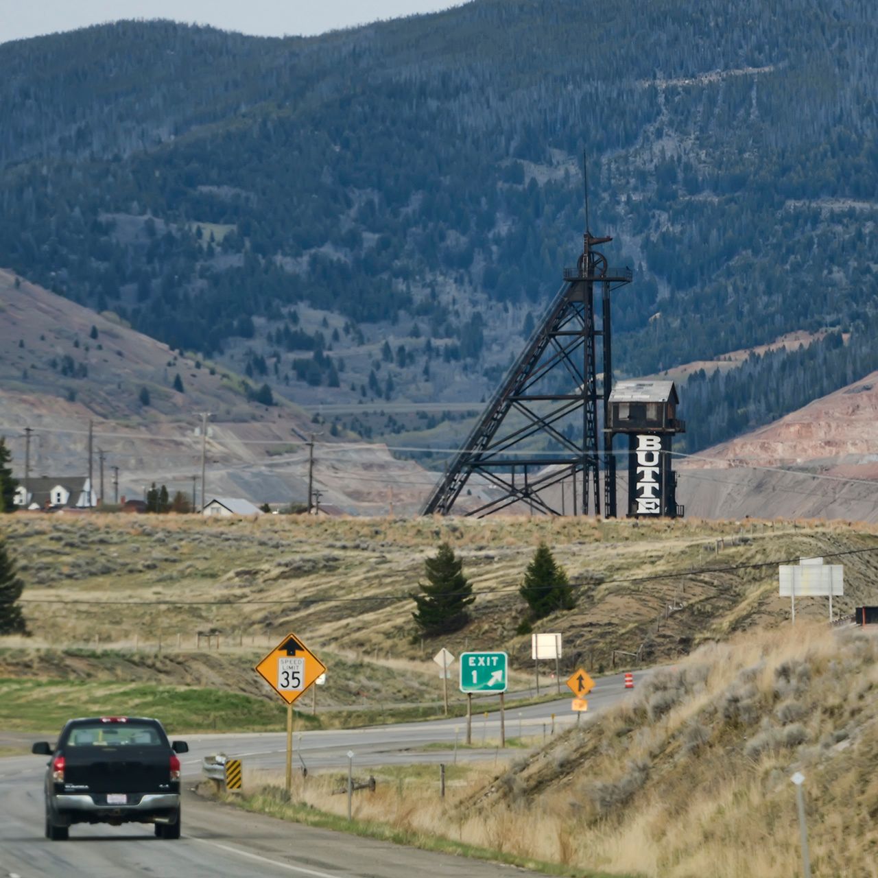
Because of its location right in the heart of Butte's historic district, the Original is one of my favorites to photograph, and is the mine most often used in logos and artwork depicting Butte.
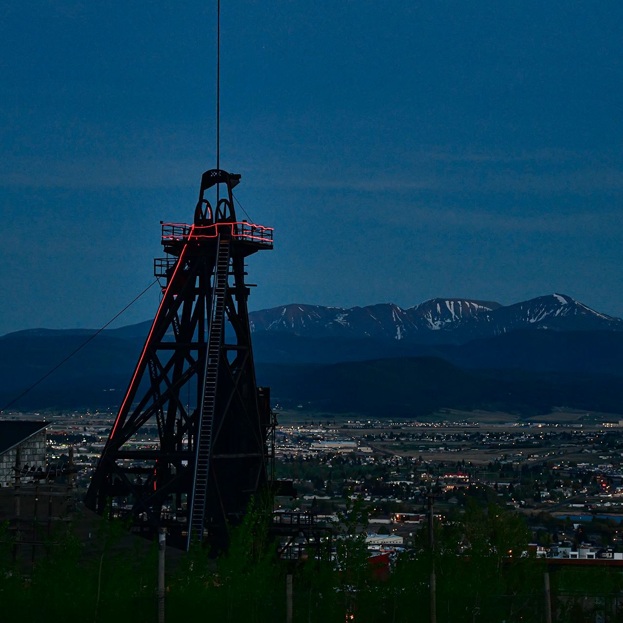
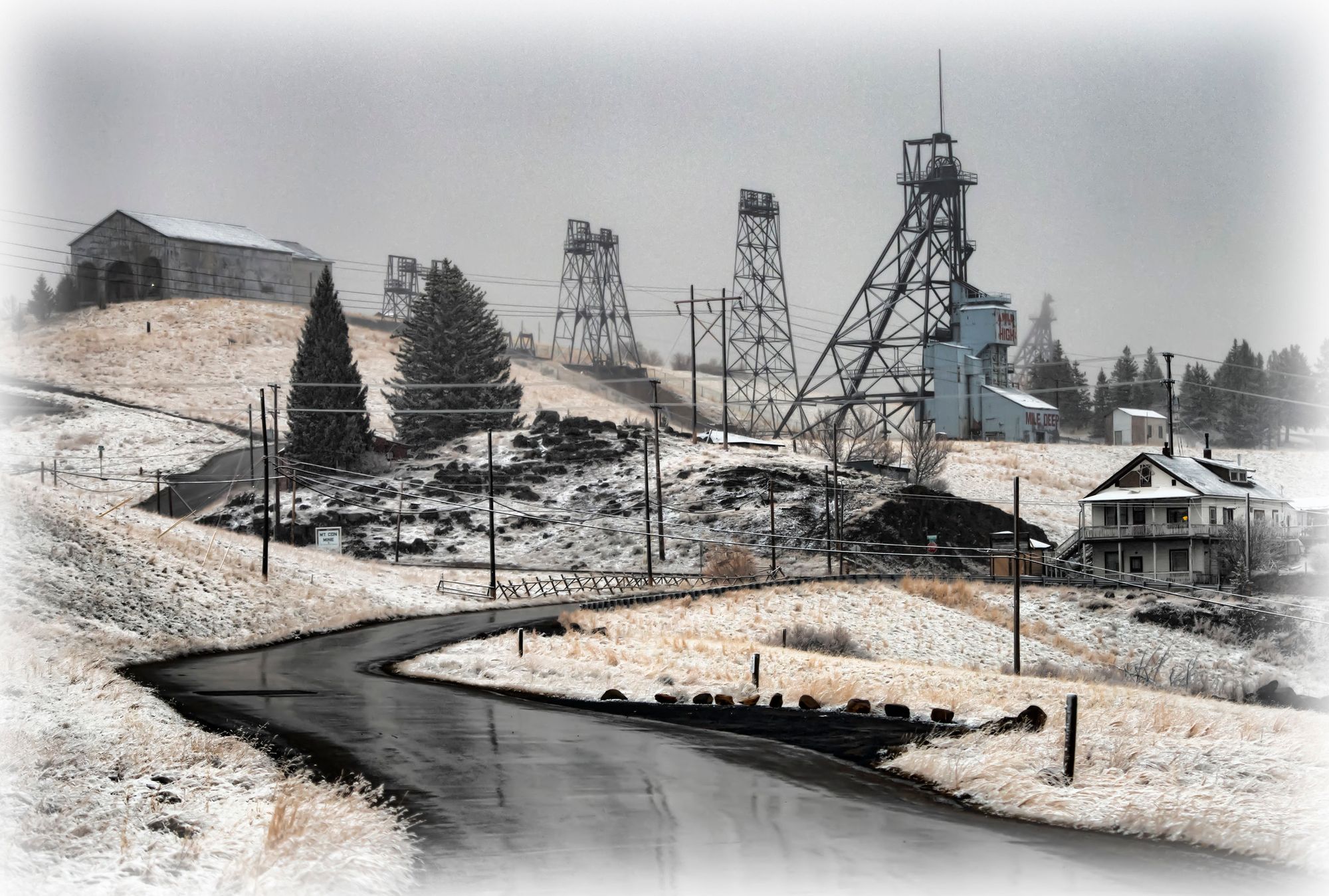
Mountain Con
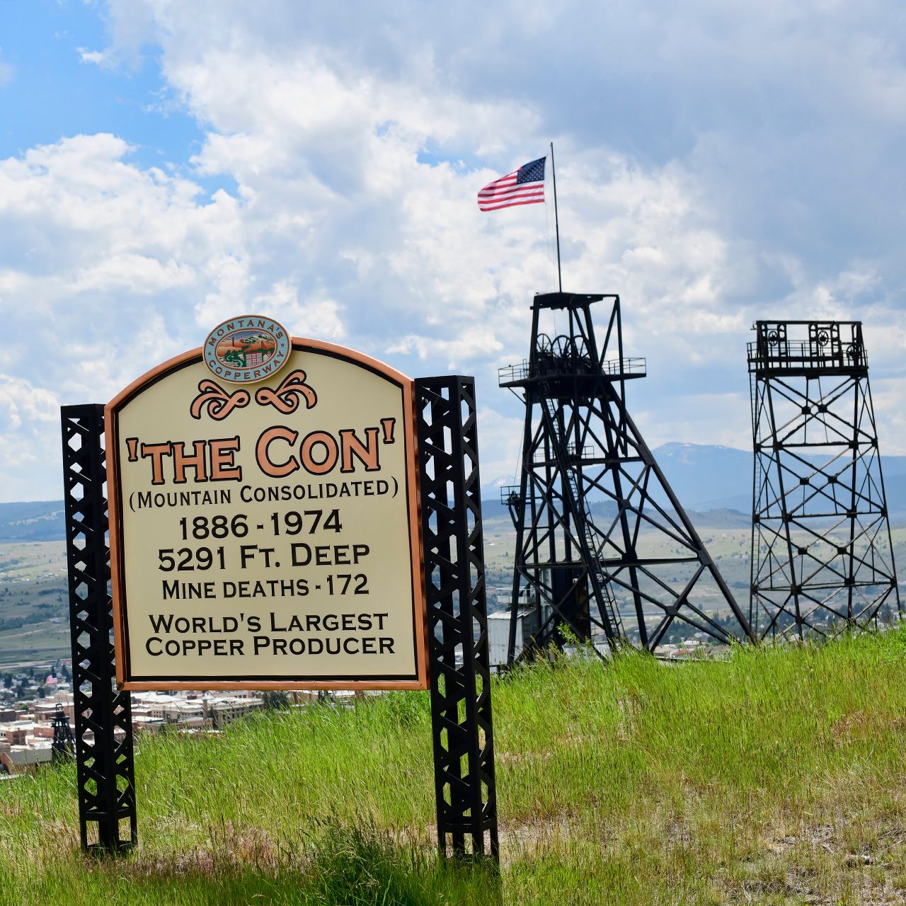
The Mountain Con headframe is right along the BA&P Trail that runs across Butte from Montana Tech up to the Granite Mountain Memorial. There is a park area with picnic shelters, benches, and public restrooms, and a nice viewpoint you can walk out to for views of Butte below.
Belmont
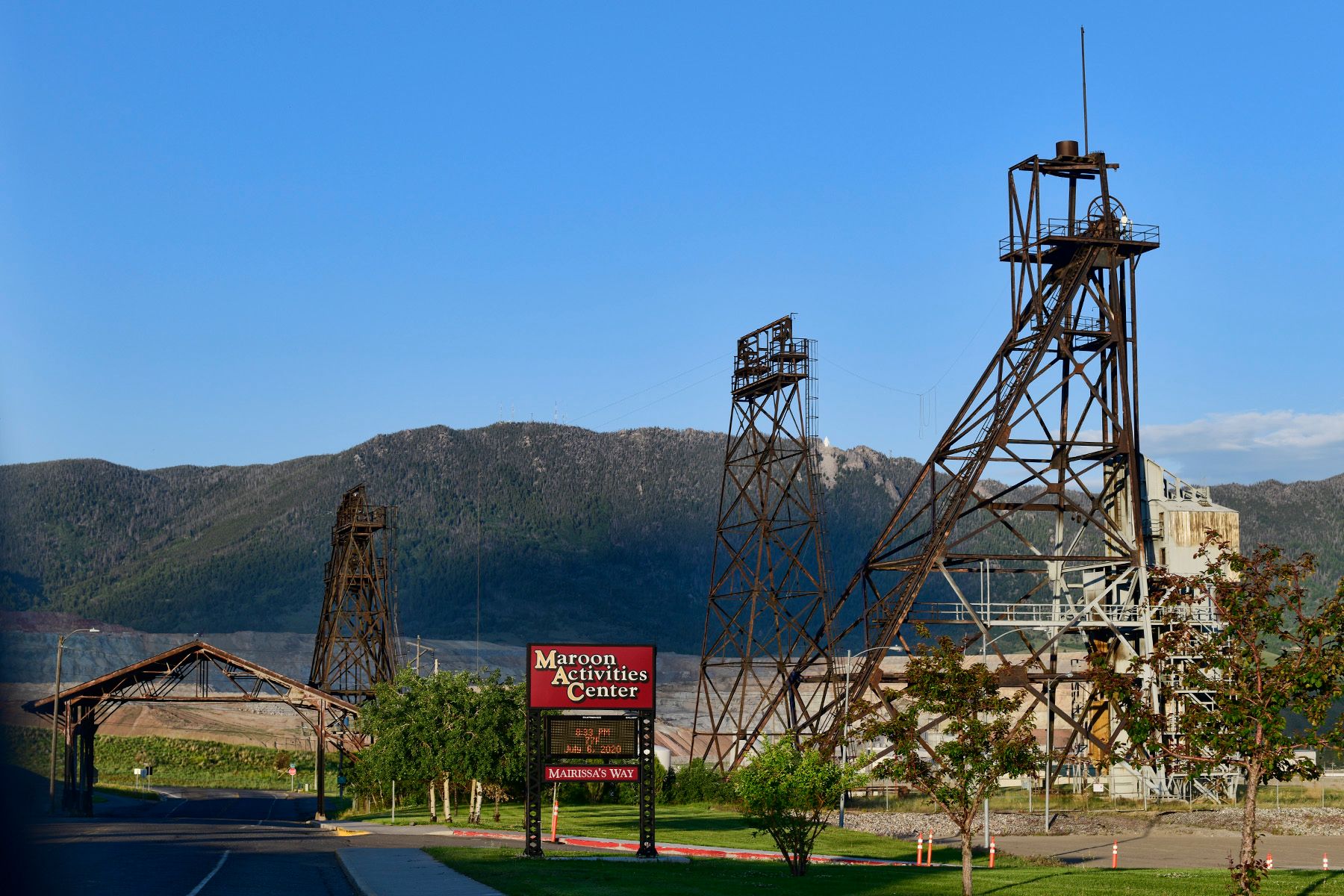
The Belmont mine was in operation from 1900 through 1956. It was 43oo feet deep and had a reputation as Butte's hottest mine, with temperatures often reaching over 100F.
Orphan Girl
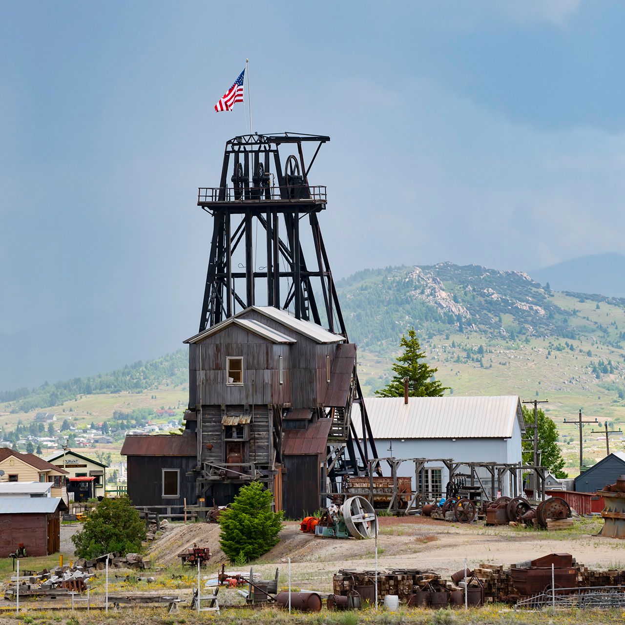
The Orphan Girl mine is the centerpiece of the World Museum of Mining, an open air exhibit of relics from the golden age of mining in Butte (roughly 1880 to 1920).
Lexington
The Lexington Mine sits high on the hill above Butte, just outside the small mining town of Walkerville. The claim was originally staked in 1865 as a gold mine, and after a slow start it became a significant silver mine in the late 1870s. By 1889 the Lexington was extremely profitable, and also the deepest mine in Montana at that time, at 1500 feet. It had several different owners over the next few decades, culminating in ownership by the massive Anaconda company, which focused on copper and zinc production until it was closed permanently in 1957.
Kelley Mine Yard
Local distillery Headframe Spirits purchased Kelley Mine Yard in 2016 and is turning the former Superfund cleanup site into a manufacturing facility that will be capable of producing a barrel of whiskey every 7 minutes.
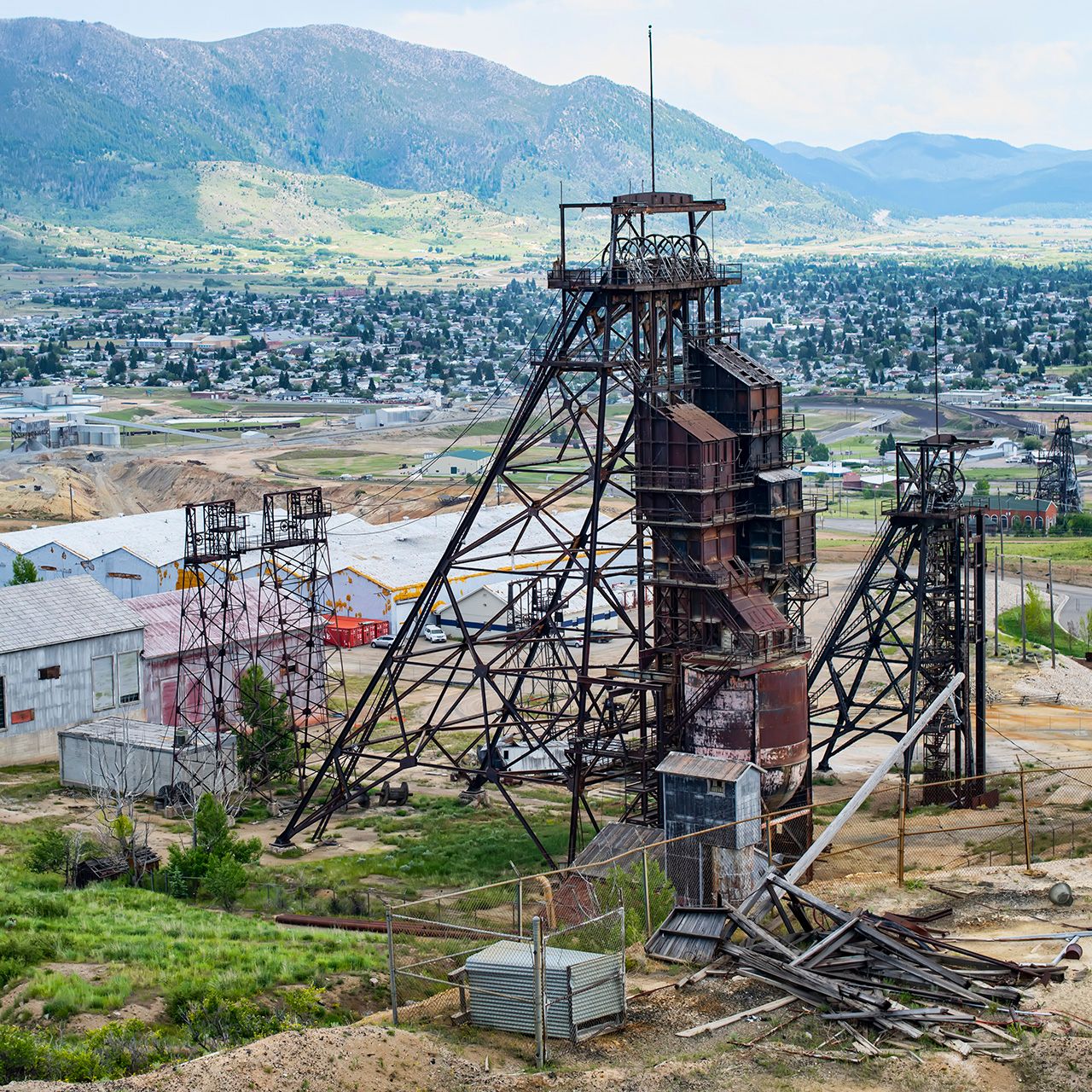
Bell Diamond
The Bell Diamond sits high on the hill above Butte in the Walkerville area. There are regulary scheduled walking tours of it, but those haven't been running this year during the pandemic.
This headframe sits above what was originally the Diamond Mine, and there was a Bell Mine about 500 feet to the east. (To the left, in the photo above.) These mines were named for the shape of their original mining claims – the areas claimed were shaped like a bell and a diamond.